
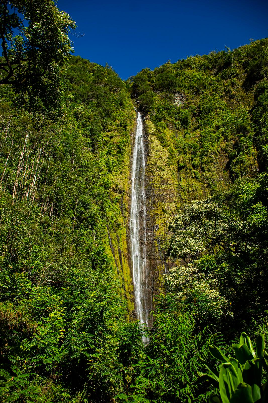
Waimoku Falls drops 400 feet off a sheer cliff face at the end of the Pīpīwai Trail, 2 miles from the trailhead, and it is the tallest waterfall you can walk to on Maui. You hear it before the forest opens. There is a shallow boulder-strewn pool at the base and a warning sign set back from it, because the hazard here is rockfall rather than depth. Plan 2.5 to 3.5 hours for the 4 mile round trip.
| Item | Figure |
|---|---|
| Height | 400 ft, tallest walk-to waterfall on Maui |
| Distance one way | 2 miles, end of the trail |
| Round trip | 4 miles, 800 ft of climb |
| Time from the trailhead | About 70 minutes up, 53 back |
| Underfoot at the base | Boulder field |
| Swimming | No. Active rockfall zone. Stay at the sign. |
| Strongest flow | Jan, Feb, Mar, Dec |
Where this sits on Pīpīwai
- 1
0.5 mi · First waterfall view
- 2
~1 mi · Boardwalks and footbridges
- 3
On this page
Waimoku viewing area
2 mi one way · 400 ft falls
How tall is Waimoku Falls?
400 feet, and it is the tallest waterfall on Maui that a person can walk to on a maintained trail. The shape matters as much as the number. Waimoku comes off the lip of a cliff in a single unbroken thread down a dark wet rock face, and the amphitheatre it has cut into the mountain is so tall and so narrow that the water breaks into mist well before it lands.
That is why the height is hard to read in person. There is nothing at the top to give you scale, no tree at the lip, no ledge halfway down. In a strong month the thread widens, picks up a second and third strand off to the side, and the whole face runs wet.
How far is Waimoku Falls from the trailhead?
2 miles one way, 4 miles round trip, with 800 feet of climb that is mostly done in the first half mile. Figure about 70 minutes up and 53 back at an unhurried pace, or 2.5 to 3.5 hours including the stops you will actually make.
The sequence on the way is Makahiku Overlook at 0.5 miles, the banyan at 0.7, the bridge at 0.9, the bamboo from 1, and the two stream crossings at 1.8. Signs at the trailhead say 4 miles round trip and GPS tracks usually come in nearer 3.6. Plan for 4.
What is it like at the base of the falls?
You hear it first. Somewhere in the last few hundred yards the sound arrives ahead of the view, a steady roar that gets under the birds and the bamboo, and then the forest opens into a boulder field and the whole cliff is above you at once. It is the best moment on the trail and it is worth not rushing.
The pool at the base is shallow and full of rock, ankle to knee deep in the parts you can see, which surprises people expecting somewhere to swim. What reaches you is mist and moving air. The falling water drags a cool downdraft down the rock face and pushes it out across the boulders, so even standing well back you are damp within a minute. On a hot day that is the reward.
Underfoot it is a boulder field, and the boulders are rounded, wet, and further apart than they look. Take your time getting to where you want to stand.
Can you swim at Waimoku Falls?
No, and the reason is not the depth. The pool is too shallow and rocky to swim in anyway. The hazard is rockfall. Everything you are standing on came off that cliff, and material keeps coming off it, and the sound of the falls covers the sound of anything smaller than a boulder arriving. The park posts a warning sign at a set-back point for exactly this reason.
A child was killed by falling rock at the base of these falls in 2011. That is the argument, and the boulder field is the evidence. Stand at the sign, take the photograph from there, and treat the pool as scenery. The mist and the downdraft reach the sign anyway, which is most of what people came for. Stream entry throughout this district is not recommended, and leptospirosis is present in the fresh water here, so keep open cuts out of it.
Where do you stand to photograph Waimoku Falls?
Well back, further than instinct tells you. To fit 400 feet into a frame you need real distance, and the closer you walk toward the pool the more of the top you lose. From the warning sign, a phone held in portrait usually gets the whole drop with the boulder field in the bottom third, which is also the shot that shows how big the thing is.
Put a person in the frame. Without one there is no scale, and a 400 foot waterfall photographs like a 60 foot one. Morning light in the amphitheatre is even and good for the rock texture, while midday sun blows out the top of the fall and leaves the base in shadow. Expect spray on the lens within seconds, and carry something dry to wipe it.
Does Waimoku Falls run year round?
Yes, it runs all year, but not at the volume in the photographs. Almost every image you have seen of Waimoku is peak flow. The strongest months are Jan, Feb, Mar, Dec, when the fall is wide, loud, and throwing enough mist that you cannot keep a lens clear. Rain is heaviest then and the trail is at its muddiest.
Through Jul, Aug, Sep the flow thins considerably. You get one narrow ribbon down the middle of a very tall wall, the mist mostly stops reaching the boulders, and the roar becomes a hiss. It is still worth the walk, and the trade is a drier trail and better footing. If a specific month matters to you, Apr, Nov sit in between and are the sweet spot: real water, less mud.
The other side of a strong month is that the streams rise. Heavy rain up the mountain arrives here as fast brown water, and after a wet night the falls can be spectacular and the trail unsafe on the same morning.
What are the stream crossings before the falls?
Two shallow crossings sit at about 1.8 miles, between the end of the bamboo and the falls. In normal conditions they are ankle deep and you rock hop across in a few steps without getting your socks wet. Depth is not the problem. The bed is rounded boulders and they are slick, so this is a place to put a hand down rather than hop.
The rule is the one that matters most on this trail. If either crossing is running fast, running brown, or hiding the bed you are about to step on, turn around. That applies harder on the way back, when the car is on the far side and the temptation is to cross anyway. Rain falling miles uphill in weather you cannot see is what fills these crossings, so the sky above you is not the signal to read. Levels drop as fast as they rise.
Questions
- How tall is Waimoku Falls?
- 400 feet, the tallest waterfall you can walk to on Maui. Makahiku, the first falls on the same trail, is nearly 200 foot and gets confused with it constantly.
- How far is the hike to Waimoku Falls?
- 2 miles one way and 4 miles round trip, with 800 feet of climb. Plan 2.5 to 3.5 hours.
- Can you swim at Waimoku Falls?
- No. The pool is shallow and rocky and it sits in an active rockfall zone. A child was killed by falling rock here in 2011. Stay at the warning sign.
- Is Waimoku Falls worth the hike?
- Yes. The bamboo forest at 1 mile and the 400 foot wall of water at the end are the two best things in the district, and they are on the same walk.
- What is the best time of year to see Waimoku Falls?
- Jan, Feb, Mar, Dec for the biggest flow and the most mud. Apr, Nov for strong water with better footing. Jul, Aug, Sep the fall thins to a ribbon.
- Are the Seven Sacred Pools the same as Waimoku Falls?
- No. Waimoku is the 400 foot waterfall inland at the end of Pīpīwai. The Seven Sacred Pools are ʻOheʻo Gulch at the coast, reached on the Kūloa Point Trail, and closed to entry.
Sources: https://www.nps.gov/hale/planyourvisit/hiking.htm · https://www.nps.gov/hale/planyourvisit/conditions.htm · https://www.nps.gov/hale/planyourvisit/kipahulu.htm · https://www.nps.gov/thingstodo/moderate-hike-up-to-bamboo-forest.htm · https://www.alltrails.com/trail/hawaii/maui/waimoku-falls-via-pipiwai-trail